
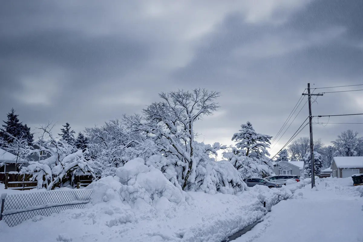
The sky may look calm, but there’s a powerful storm building far above our heads—and it’s arriving sooner than expected. A rare atmospheric event is twisting weather patterns in extreme ways, setting the stage for a winter storm that could bring up to 3 feet of snow and winds reaching 70 mph in some regions. If you’re wondering why winter suddenly feels like it’s taken a wild turn, the answer begins 30 kilometers up in the sky.
What’s happening: A polar vortex under attack
The term “polar vortex” gets thrown around a lot during cold spells, but this time it’s truly living up to the hype. What’s going on now isn’t just a minor shift—it’s a major disruption caused by a sudden stratospheric warming (SSW).
In early February, temperatures in the stratosphere above the Arctic jumped by 40 to 50°C—not on the ground, but high in the atmosphere. That burst of warmth didn’t go unnoticed. It slammed into the polar vortex like a punch to a spinning top, stretching it into two separate lobes and sending cold air drifting toward both North America and Eurasia.
Why does this matter to you? Because that chaos aloft soon filters down. It changes the jet stream—our weather’s steering wheel—causing it to slow, buckle, and warp. That’s when things get weird on the ground.
What to expect: A season of surprises
This isn’t just a one-day storm—it’s weeks of unpredictable conditions. Weather models show a sluggish jet stream pattern that’s likely to trap systems in place. That means stuck cold fronts, surprise warmups, and sudden dumps of snow.
Here’s what we could see unfold:
- Blizzard conditions in parts of the northern U.S., with snow totals climbing to 3 feet
- Coastal regions may face gusts up to 70 mph, strong enough to down trees and power lines
- Transition zones with rapid temperature swings, where snow turns to freezing rain in hours
- Blocked weather patterns that keep storms hovering over one region for longer than usual
Heads up: even if your area isn’t normally impacted by severe winter weather in February, this year could be different. In 2018, a similar disruption triggered the so-called “Beast from the East”, covering parts of Europe in deep snow and freezing air. North America saw its own version in 2014 and 2019. This time, ocean temperatures are unusually warm, which could cause even sharper contrasts across short distances.
How to prepare without panicking
Storm alerts and scary headlines don’t mean you need to become a survival expert overnight. The goal here is to plan smarter, not harder. Start with these simple, flexible steps:
- Look at 3–7 day forecasts regularly. Don’t just rely on the “today’s weather” tab. Trends matter more than icons.
- Have basic winter gear ready: snow shovels, blankets, batteries, and storm food (even just a few extra cans).
- Mentally prepare for changes to routines—delayed commutes, canceled plans, or icy sidewalks on short notice.
- Follow local alerts from trusted meteorologists. They’ll know how the big picture affects your neighborhood.
Strong, sudden flips in weather can also impact your mood and sleep, especially if it’s gray and stormy day after day. Making a few small routines—like pairing outdoor chores with a hot drink or morning forecast check—can add just enough structure to help.
No, the vortex isn’t collapsing (but it is shaking things up)
Let’s clear something up: the polar vortex isn’t breaking forever. It’s part of nature’s cycle and will re-form next winter. But this unusually intense February disruption is pretty rare—it usually happens in January, not this late in the season. That makes this event especially powerful and surprising.
Climate scientists are still studying the connection between Arctic warming and these kinds of vortex patterns. Some studies suggest that a warmer Arctic and shrinking sea ice might nudge the jet stream into weirder shapes, but the science isn’t settled yet.
What now? Keep one eye on the sky—and your plans flexible
You’ll probably notice weird weather moments this month: snow piling up while flowers bloom nearby, afternoon warmth followed by icy morning roads. It helps to think of this as a natural wobble—a big one, yes, but still a phase that will pass.
The truth is, this storm and its aftermath will likely touch millions. But how it feels—whether chaotic or just slightly annoying—depends on how you prepare. The weather may be unpredictable, but your response doesn’t have to be.
So go ahead: check that forecast a bit more often, salt your steps before the ice comes, and maybe say yes to that second cup of cocoa. The polar vortex might be doing strange things, but you’ve got this.